Locating bus stops as accurately as possible
by multimob — written on 2024-02-15
The usual input we obtain from GTFS is the latitude and longitude of a given stop. In most cases, one should expect this to be a raw location, typically a few meters or a few dozen meters away from the real location.
Here is an example: the node is generated with the lat and lon values from GTFS. Not that bad, because it is in the vincinity of the bus stop. But not that good either.

The usual task will now be to examine the available aerial imagery and improve this location.
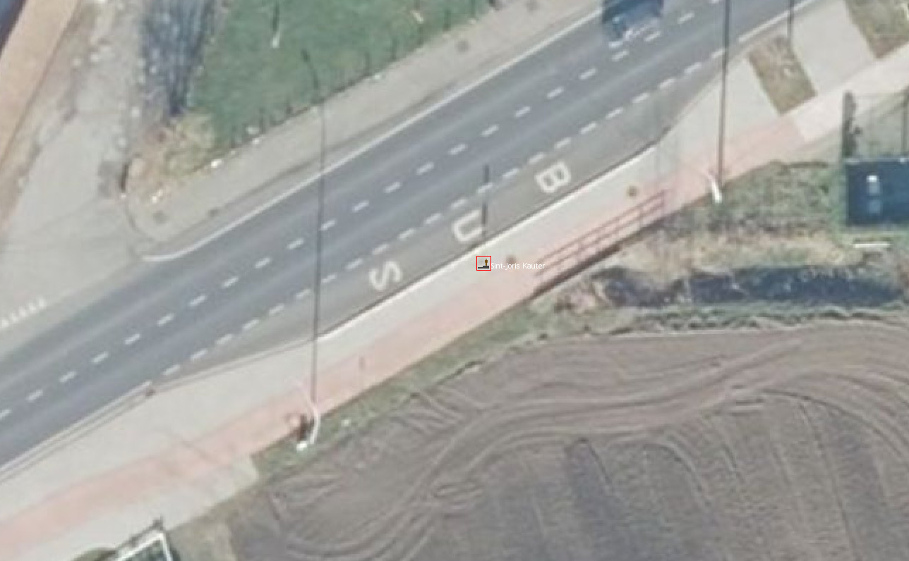
The situation here is rather straightforward because aerial imagery shows no doubt that there is a bus stop here, and we can even see the stop post very clearly. For a simple stop, the most logical assumption shall always be that the stop node should be the stop post itself. This is because routing software will try to bring people there.
We see a few potential problems here, though:
- If you compare the distance between GTFS data and OSM nodes, being different is often assumed to being wrong.
- Consequently, one needs to set up a system where we can tell stops apart: some are far away from GTFS data because they have never been examined, and some are also far away but have been checked and we have good reasons to believe that OSM data is correct and GTFS isn’t.
- There is no worldwide consensus about where the stop platform node should be exactly located. Some people will say that guiding users to the shelter is better, others will argue that the front door of the bus is the reference point. The list is endless. But micromapping is definitely not a priority given the amount of stops to verify.
Permalink: https://blog.multimob.be/zztaih3tb0.htm