How bus stops reflect a territory?
by multimob — written on 2023-04-14
You may wonder what the following map is about. Are we showing the population density in Flanders here? Or is it how the Region is visible from the sky during the night? No, it is just a simple plot of all tram and bus stops operated by De Lijn.
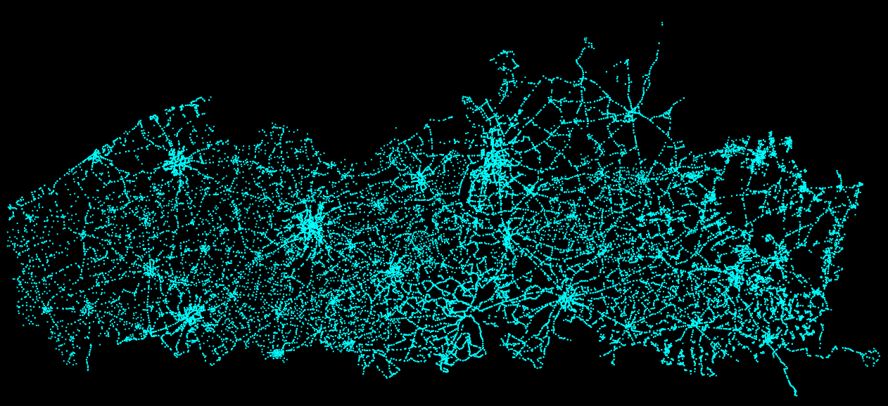
This map is very interesting. A distinct pattern emerges here: a dense network of stops in major cities, fewer stops in suburban areas, and even fewer in rural regions. This distribution is not arbitrary; it reflects the underlying human geography and the concentration of activities. We can see urban sprawl, shopping centers or expo halls (Flanders Expo, Sportpaleis) outside city centres, and major roads connecting the various towns.
Though bus stops are perceived as few and far between in rural areas, the map illustrates that the overall density is very high. This is a consequence of public policies of the past, namely Basismobiliteit, even though this is expected to change in the next months, many rural stops will be entirely dropped in the next two years.
Nevertheless, the distribution of bus stops across a country is a tangible reflection of human geography. It highlights where people live, work, and engage in various activities. Dense urban networks demonstrate the need for extensive public transport to support vibrant city life, while sparser networks in suburban and rural areas indicate different patterns of human settlement and activity.
Understanding the relationship between public transport and human geography is essential for planning and developing sustainable transport systems. It ensures that the needs of different regions are met and that public transport can effectively support economic, social, and environmental goals.
Permalink: https://blog.multimob.be/zz38ddqeg2.htm